Water Resources Data made simple for
NRDs.Ground Water Districts.Irrigation Districts.Canal Companies.Augmentation Plans.State Agencies.Irrigators.Municipalities.
Stop relying on spreadsheets, small local databases, text files, GIS files and use our all-in-one solution to enter, store, and analyze your data.
Trusted by more than 20 groups so far including:

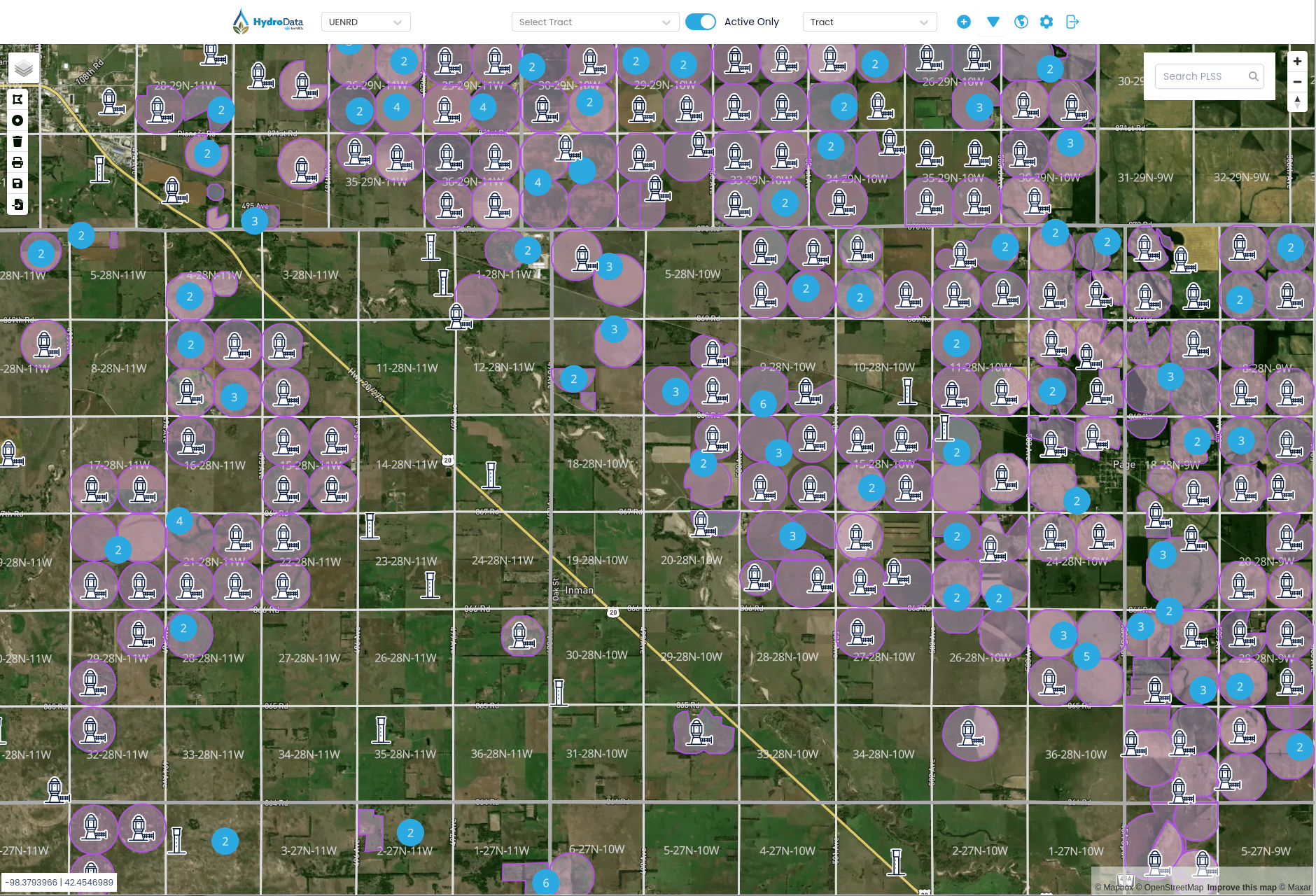
Everything you need to keep track of Water Resources in one place.
Anything from location of items, updated usage, analysis, and even reports.
All major components have a location attached to them, from tracts and parcels to wells and flowmeters, all have easy point and click locations.

Simplify your water resources tasks.
Make data entry, processing, retention, analysis and even updating people a little easier.
Connect with Producers
Connect with producers and users through ProducerConnect Add-on
Your producers and users need information updated quickly and you need to communicate quickly, do so with our separate add-on.


Mobile App Data Collection
Let the field staff collect data on mobile apps for iOS and Android
Collecting field data doesn't have to be difficult, use our mobile apps to collect items like meter reads or water levels

User Administration
Choose access levels for each user to ensure the appropriate access
Users can range in access from Administration to read-only and everything in between so the employees can get access to data without changing it.

Connect with producers and users through ProducerConnect Add-on
Your producers and users need information updated quickly and you need to communicate quickly, do so with our separate add-on.

Let the field staff collect data on mobile apps for iOS and Android
Collecting field data doesn't have to be difficult, use our mobile apps to collect items like meter reads or water levels
Choose access levels for each user to ensure the appropriate access
Users can range in access from Administration to read-only and everything in between so the employees can get access to data without changing it.


Get started today
It’s time to empower your staff to enter data, map items and stop focusing on being developers and database engineers.
Click to schedule a live demo!Simple pricing, for any organization.
Annual subscriptions based on items or acres that you tract along with add-ons that you may want to include.
Annual Subscription
Basic Application that is a great starting point, with many features and mobile apps included
Base Application
- Map based web application
- Unlimited user accounts for organization
- Collect data for tracts, wells, meters, structures
- Extensive reporting included
- Access to mobile collection applications
Annual Subscription Add-on
Allows the members to sign-in and view their data, submit reports and receive messages
Producer Connect
- Users tracts in Hydrodata can sign-in
- Can submit meter reads, crop reports, and soil tests
- Can view water usage
- Map based for easy access
- Mobile Apps for iOS and Android
- Send notifications to users on important events
Annual Subscription Add-on
Allows to inventory and records inspections and maintenance
Dam Inventory
- View map based locations of each dam
- Report inspection and maintenance status
- Collect field data using mobile apps
- Schedule inspection dates
- Report on required maintenance items

Frequently asked questions
Here are questions many prospective users have when seeing if our product is a good fit, we hope these help you.
What type of Map do you use?
Our maps use industry standard web maps for displaying all types of data
Can an item not have a location or I haven't collected it yet?
Absolutely, items can exist in the system without a location but that limits some functions, you can easily get the location in the mobile apps
Can I edit on the map?
We make it easy so everyone can use the maps and no one needs to be a GIS specialist to move a location or update a boundary.
What types of relationships do you have for tracts and wells?
Hydrodata allows you to associate (or not) tracts to flowmeters, structures, wells, chemigations, entities (people), crop reports and soil tests.
How many entities and what types can be on an item?
Entities are not limited on a item, there are four classes of Owners, Operators, Contacts, and Consultants. You also keep tract of previous ones by making them inactive.
Will the mobile app(s) work without service?
We designed the mobile apps for areas with poor service so that you are able to collect the data, save it to your device and then save it when you get back to WiFi coverage.
Can Producer Connect be used by itself?
ProducerConnect is an add on to Hydrodata that enables the entities (people) to sign-in. It cannot be used on its own since the data it displays resides in Hydrodata.
Do I have to pay for updates?
Your annual subscription covers all updates during that time period, no additional fees are required to maintain the latest version.
What if I would like a feature that you don't have?
We allow subscribers to purchase "Feature Requests" that adds a item to the application that you would like. Please contact us for more details.


